Airborne Research Australia
Not-for-Profit Independent Approved Research Institute

All Donations are tax-deductible.
We thank you for your consideration.
Iron Range Rainforest, Cape York
Collaborative Project with the Iron Range Research Station (IRRS)
funded by the MAXIM Foundation
Participants: The ARA Team; Anita & Keith Cook, Gabrielle Davidson, Tony Peter, IRRS/MAXIM Foundation
While the importance and plight of everwet rainforest is generally accepted, comparatively little attention has been paid to tropical dry forests - high-biomass, species-rich biomes that thrive in marginal conditions and hold international significance for biodiversity conservation and carbon sequestration. These ecosystems are generally poorly represented in the conservation estate and are subject to a variety of threatening processes, the interplay of which is not well understood.
Within Australia, tropical dry forest covers a relatively small area but contributes disproportionately to biodiversity. This ecosystem reaches an apex of complexity and development on Cape York Peninsula, an area internationally recognised for its high diversity and low disturbance status. Closed forests in this region occupy only 5.6% of the Peninsula’s area, but contain 47% of its plant species, 60% of its frogs, 35% of its reptiles, and 40% of its birds and mammals.
Recently, the Iron Range Research Station (IRRS) in collaboration with Airborne Research Australia (ARA) gathered airborne lidar data of the largest contiguous block of lowland forest remaining in Australia.
This data will be used in conjunction with terrestrial laser scanning with the Riegl VZ-400i, and biomass quantification via automatic extraction of individual trees and estimates of their volumes from terrestrial pointclouds.Plot based diversity surveys have also been carried out.
This novel combination of highly detailed airborne and terrestrial laser scanning with diversity data will generate new insights into the complex interplay between topography, fire susceptibility, biomass and diversity within this region, and has national and international implications for the tropical dry rain forest biome and the opportunities it offers as a vehicle for carbon sequestration.
(text by Gabrielle Davidson, IRRS)
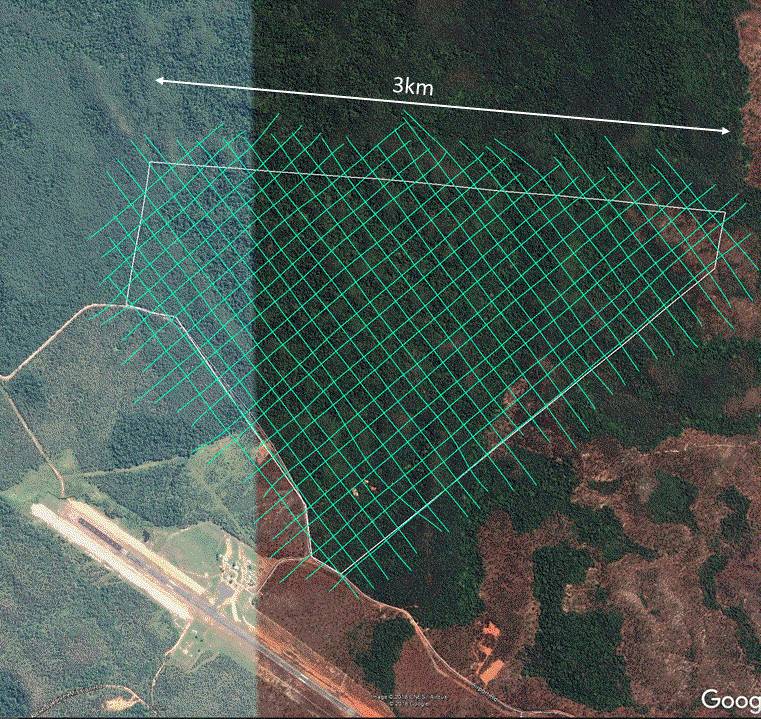
Flightlines over the IRRS for very high point density Lidar

Flightlines over the rainforest for high point density Lidar

Flightlines over the IRRS for very high point density Lidar

Lockhardt River Airport
Transmission Tower near Lockhardt River see by Lidar

Research aircraft and flightcrew

IRRS kitchen
"Removing" the rainforest on Cape York reveals a landscape
of hills and creeks that no human eye has ever seen.


Nothing but trees.... ...nesting mounds Nothing but trees... ....old diggings from
(aerial photo) of scrub fowls (aerial photo) a mini-goldrush invisible below. invisible below.


Using our high-resolution airborne Lidar,
we were able to find out what's hidden under the very dense canopy of the rainforest.
See the whole landscape with the "Trees/noTrees" sliders:
This project has now lead to a new facility available at ARA for science applications
- a State-of-the-Art Terrestrial Laser Scanner (TLS) Riegl VZ400i.

-
High laser pulse repetition rate of up to 1.2 MHz
-
High speed data acquisition up to 500,000 measurements/sec
-
Wide field of view, 100°x360°
-
Range up to 800 m, accuracy 5 mm
The TLS can be used as a stand-alone sensor
or make a powerful combination with the existing ARA airborne Lidars (ALS).
Some examples can be seen here.
The MAXIM Foundation is a Not-For-Profit organsation based in Cairns.